Upcoming Events

Shoreline Adaptation Engagement Effort

Corte Madera’s shoreline neighborhoods face flood risk and impacts that are increasing due to multiple factors. The Town is beginning an effort to engage our shoreline neighborhoods in a discussion about potential strategies to address flooding impacts resulting from high tides, heavy rain events, subsidence, sea level rise, and other vulnerabilities. This effort aims to provide all shoreline residents and stakeholders with the best, most recent information about current and future vulnerabilities and the opportunity to share their ideas, hopes, concerns, and needs with Town staff and leaders. This listening tour and discussion, continuing through Spring 2024, will help the community to collectively determine the best course of action for our shoreline neighborhoods moving forward.

Goals

  • Engage with shoreline residents and stakeholders.

  • Share up-to-date information about current and future flood vulnerabilities and the range of possible adaptation measures.

  • Listen to the ideas, hopes, needs and concerns of shoreline neighborhoods and adjacent areas in the floodplain.

  • Develop a community vision for shoreline adaptation in partnership with the community and Town Council.


Contribute to the Collaborative Flooding Map

Have you experienced flooding in Corte Madera’s Shoreline Neighborhoods? Drop a pin on the map below to help the Town and community members build a comprehensive understanding of how flooding is affecting our Town.

Please add photos and any relevant details (the date/time of the flooding, whether it was a one-time experience or reoccurring in a given location, the tide, and the rainfall). You can look up today’s tide here, or find a historical tide here. The more information you can add to your marker the better, but don’t worry if you only know some of these details. Thank you for contributing!

Click here to view the map full screen, or use the buttons on the top bar of the map to add a comment.


Engagement Timeline


The Town is committed to engaging residents most affected by flooding and ensuring that the future of Corte Madera is grounded in the needs of the community. There will be a wide range of engagement activities designed to meet residents where they are and provide a platform for conversation, understanding needs, and sharing information in order to develop a shared community vision for shoreline adaptation. Visit the Get Involved page to attend an upcoming event.


Frequently Asked Questions

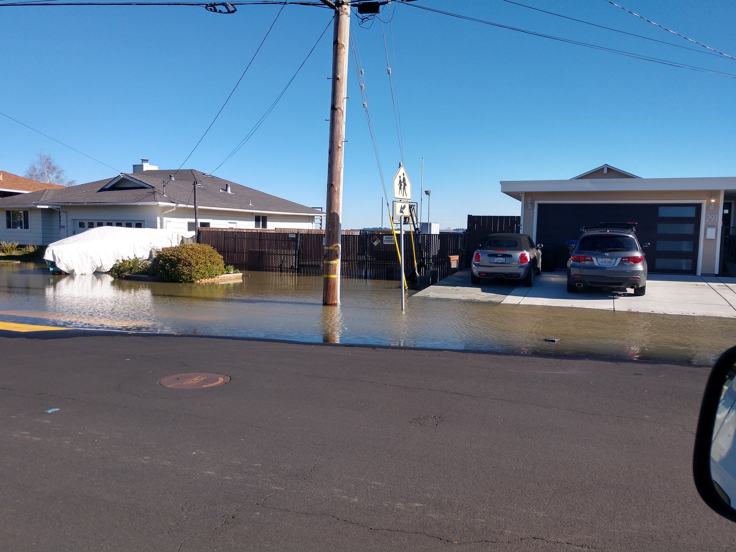
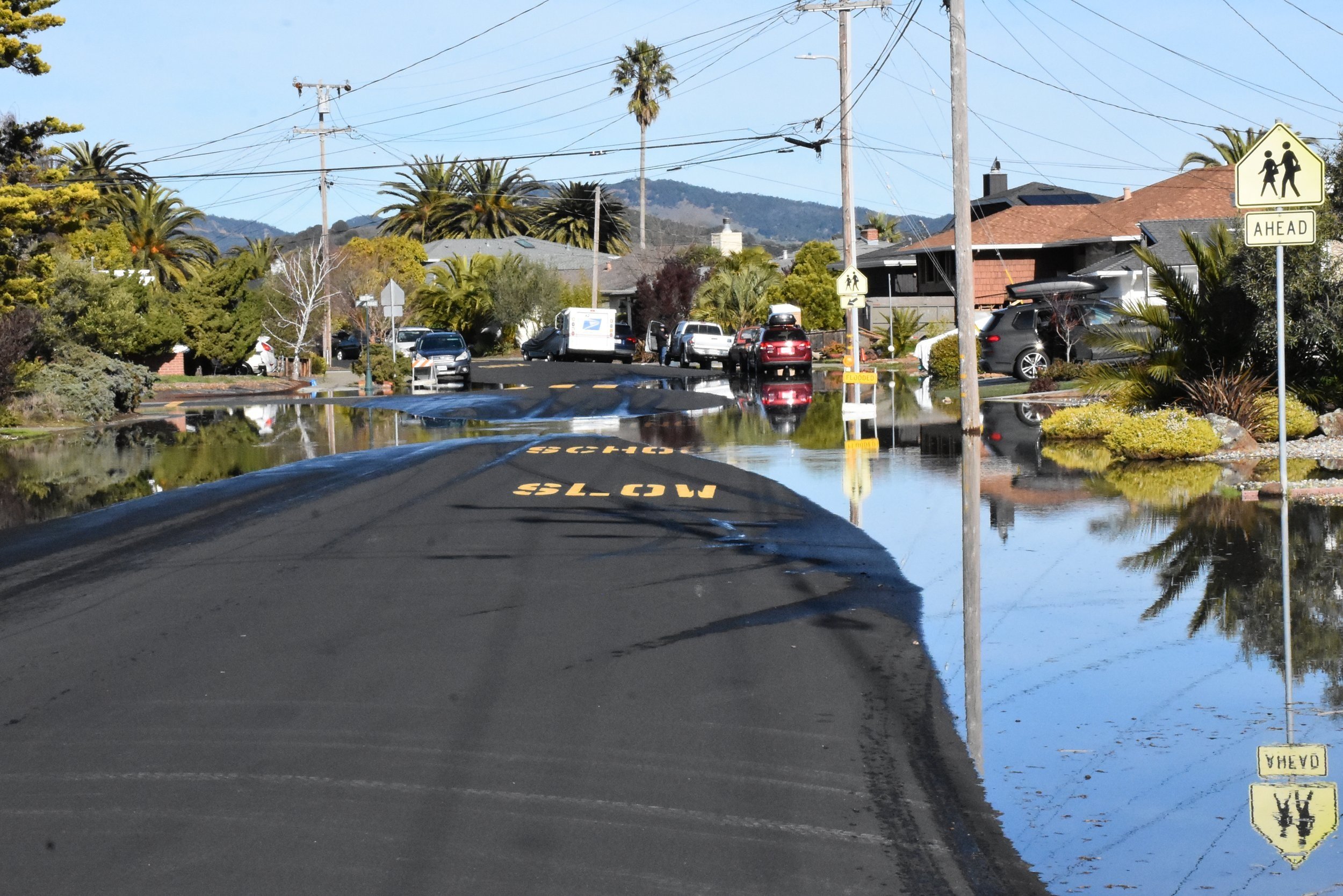
  • Multiple factors contribute to flooding in Corte Madera’s bayside neighborhoods, including high tides, stormwater runoff, settlement (also known as subsidence), sea level rise, and storm drainage infrastructure that was part of the original developments and is no longer adequate to meet current needs. Long-term factors like settlement and sea level rise are, over time, increasing the flood risk that shoreline neighborhoods face by lowering neighborhood elevations and increasing water levels, respectively. Short-term factors, like high tides and storm events, build on existing vulnerabilities to cause temporary flooding. Learn more about these factors below.

    Long-Term Factors:

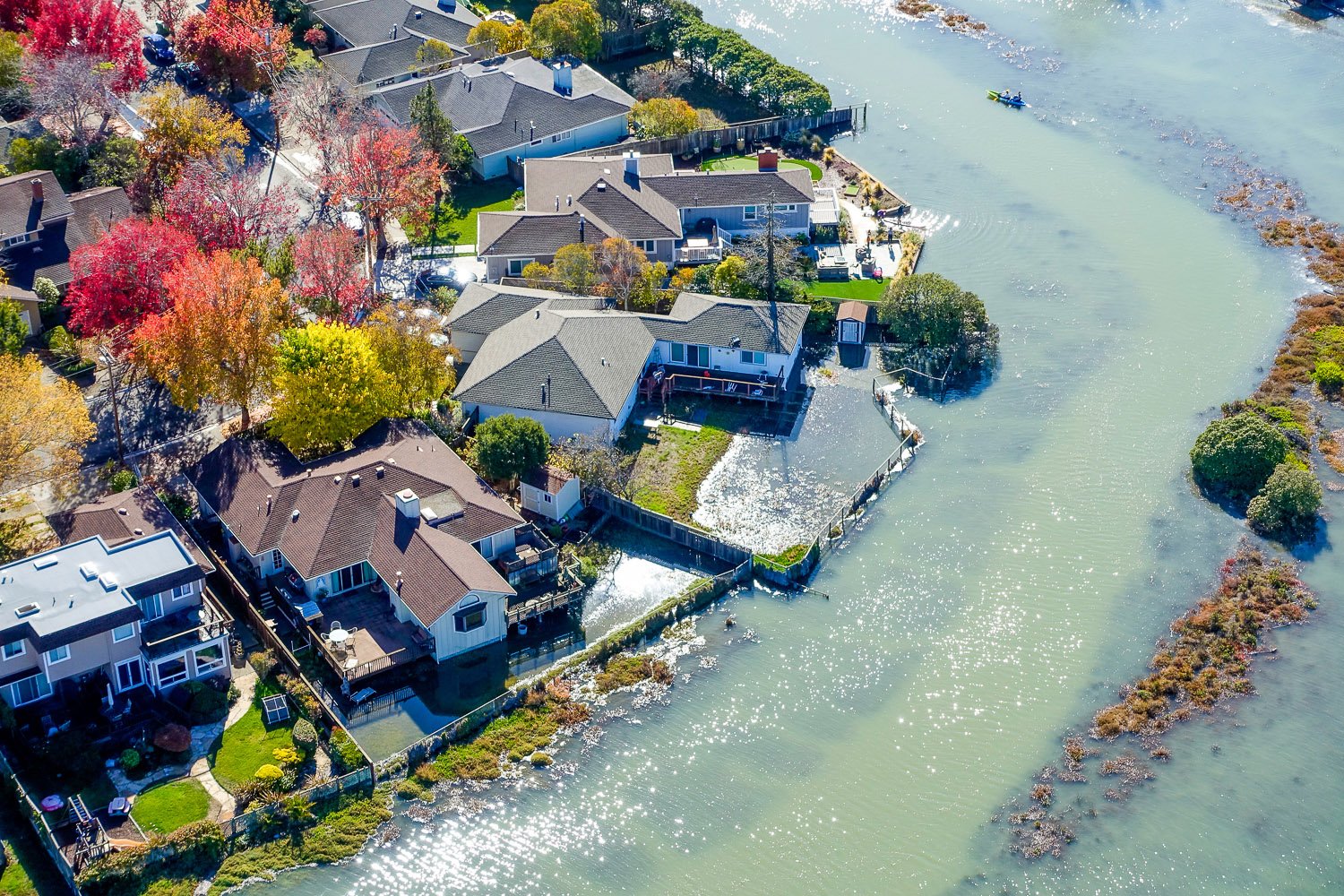
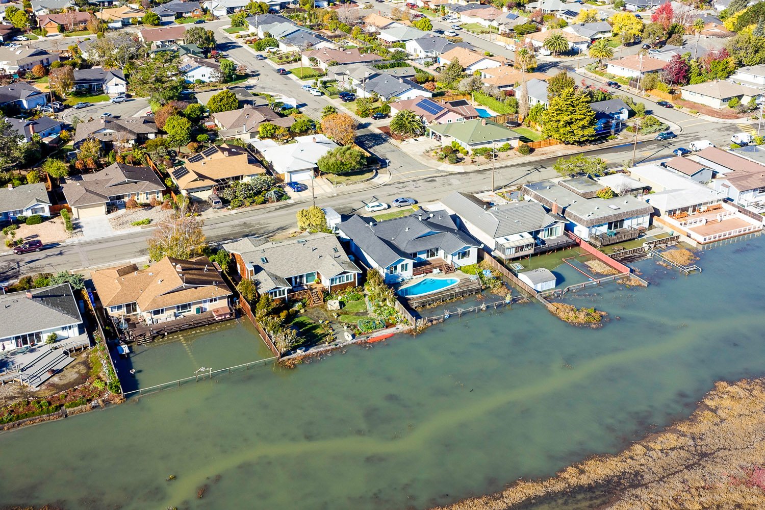
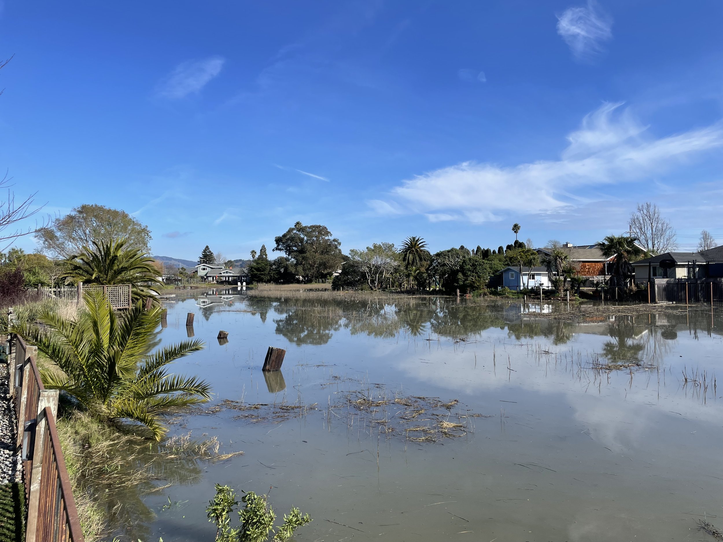
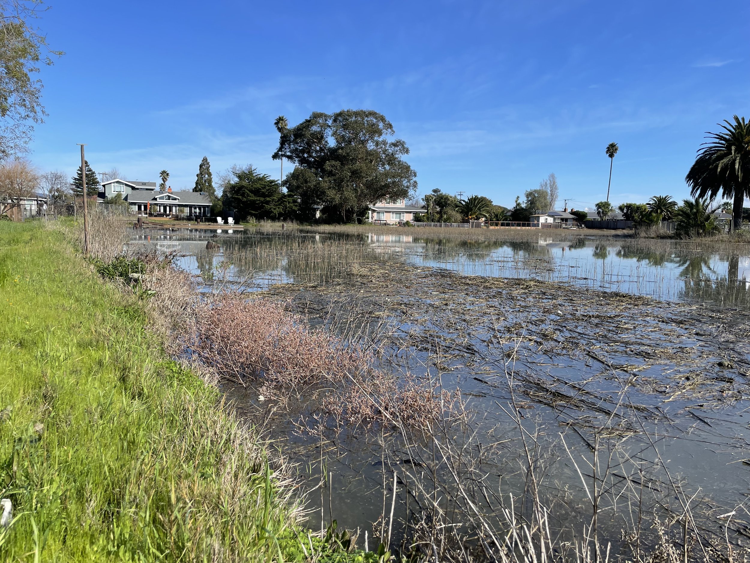
    Settlement: The bayside neighborhoods of Mariner Cove and Marina Village were built on filled baylands in the 1950’s. The neighborhoods have subsided as the bay mud and former marsh solids consolidate under the weight of the overlying infrastructure (e.g., earth fill, roads, homes). These neighborhoods have settled up to four feet since construction (depending on the thickness of the bay mud) and are projected to continue settling for the coming decades, with an average of up to 2 additional feet of settlement by the end of the century. In some places, settlement has resulted in homes with tilted floors and storm drain pipelines that no longer flow as originally designed. For more information on settlement, see the Town-Wide Storm Drainage and Flood Control Study - Phase I, 2007, pp.10-11.

    Sea Level Rise: Sea levels in San Francisco Bay have risen eight inches over the past century (CA Fourth Climate Change Assessment, 2018) and will continue to rise over the next century. The exact amount of sea level rise we see will depend on multiple factors, including how well we reduce our greenhouse gas emissions. The most recent guidance from the State of California recommends planning for 1-2 feet of sea level rise by 2050 (CA Sea Level Rise Guidance, 2018), with updated guidance expected to be released soon. Rising sea levels exacerbate the extent of tidal flooding, worsen creek overflow due to backwater effects of elevated high tides, elevate the groundwater table, and can intensify wave action that erodes the shoreline currently protecting infrastructure.

    Short-Term Factors:

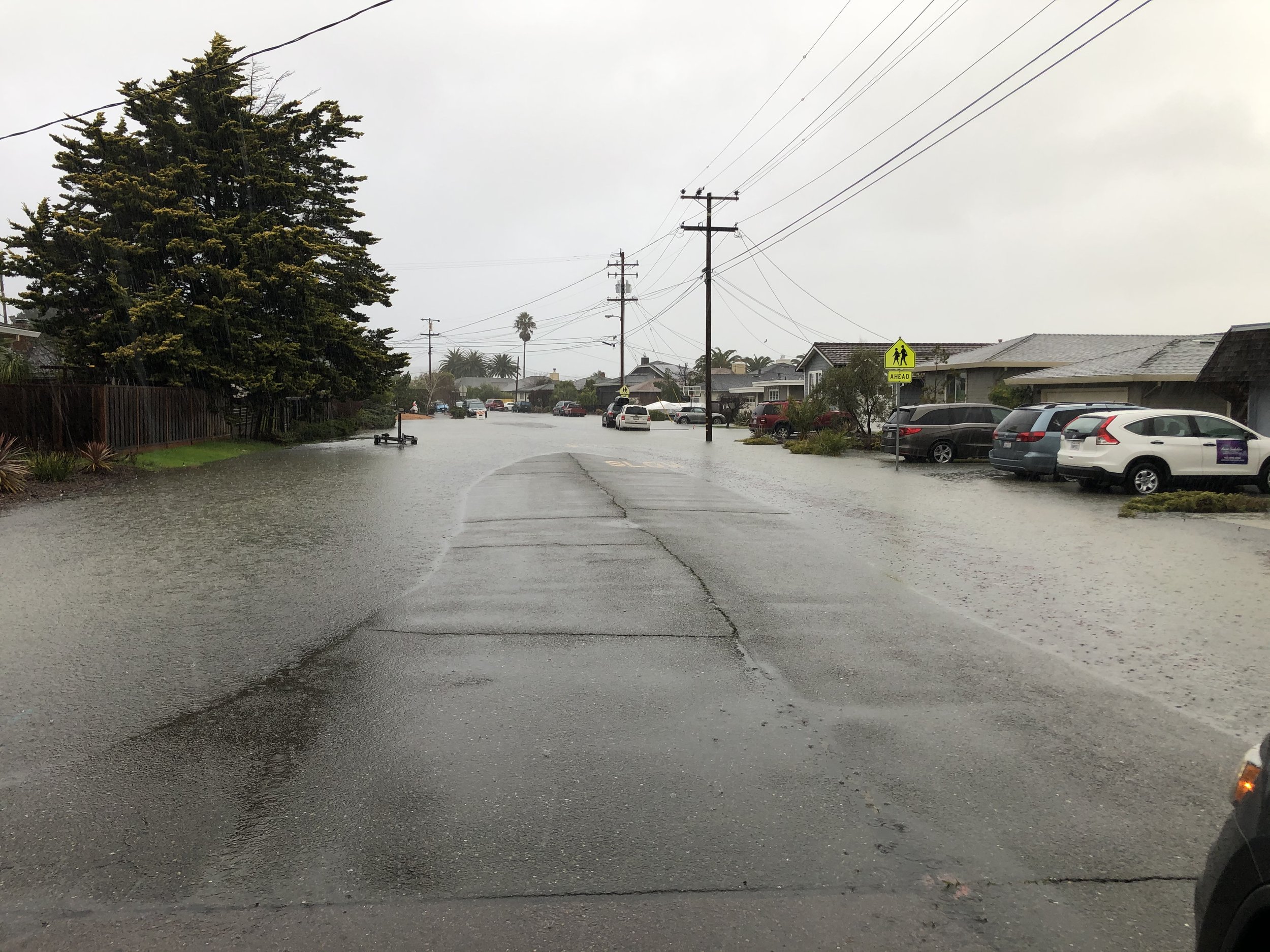
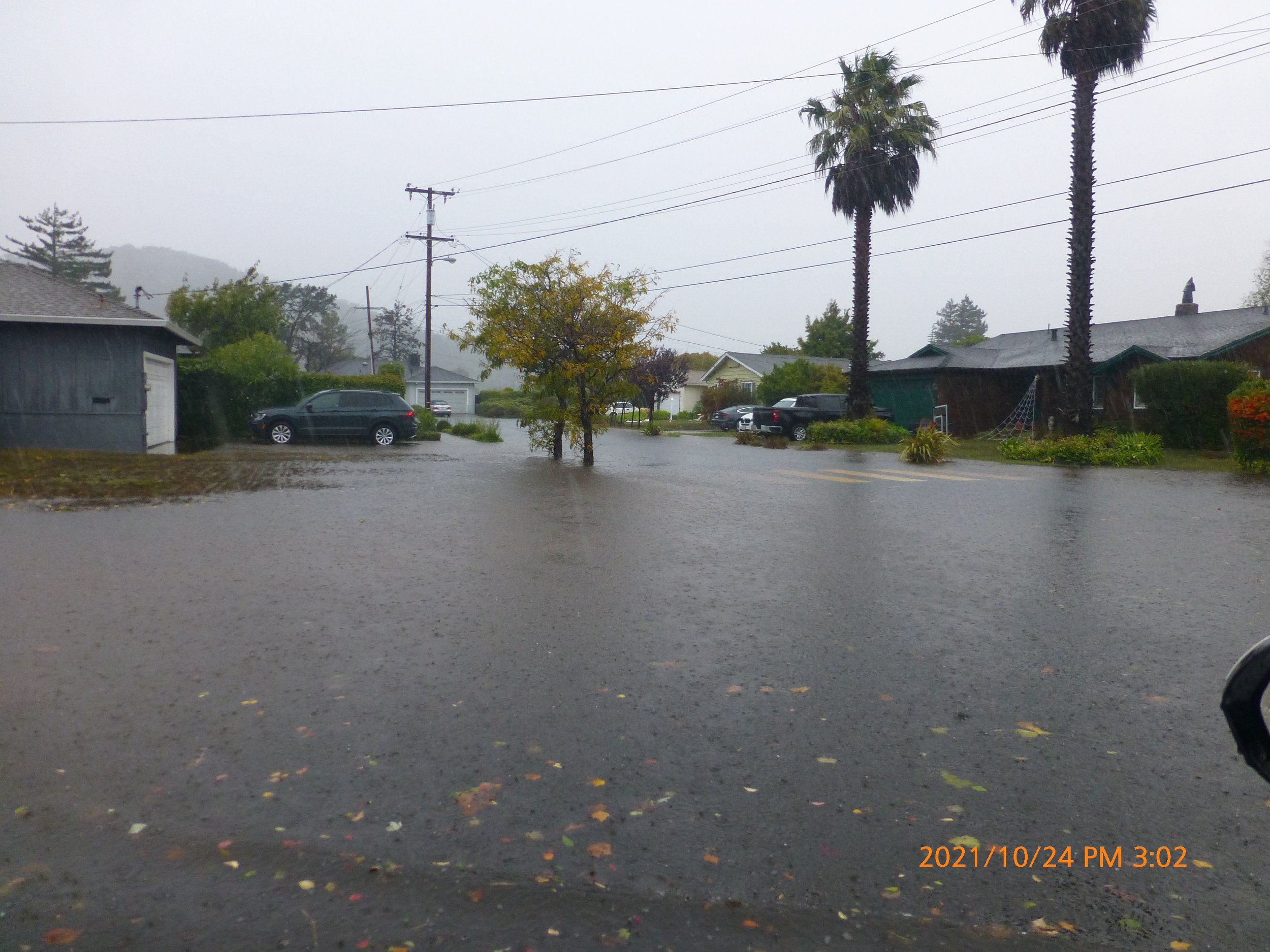
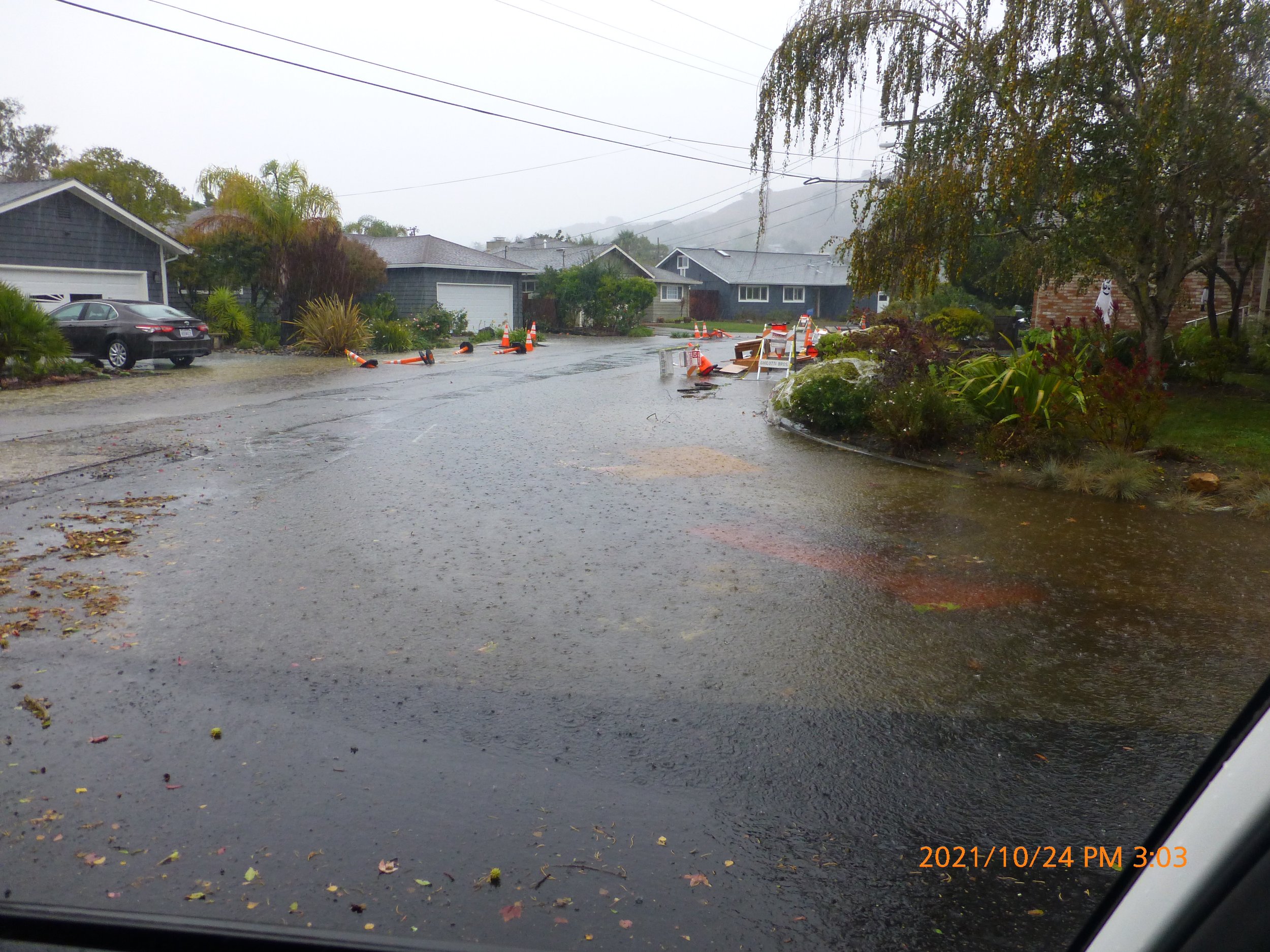
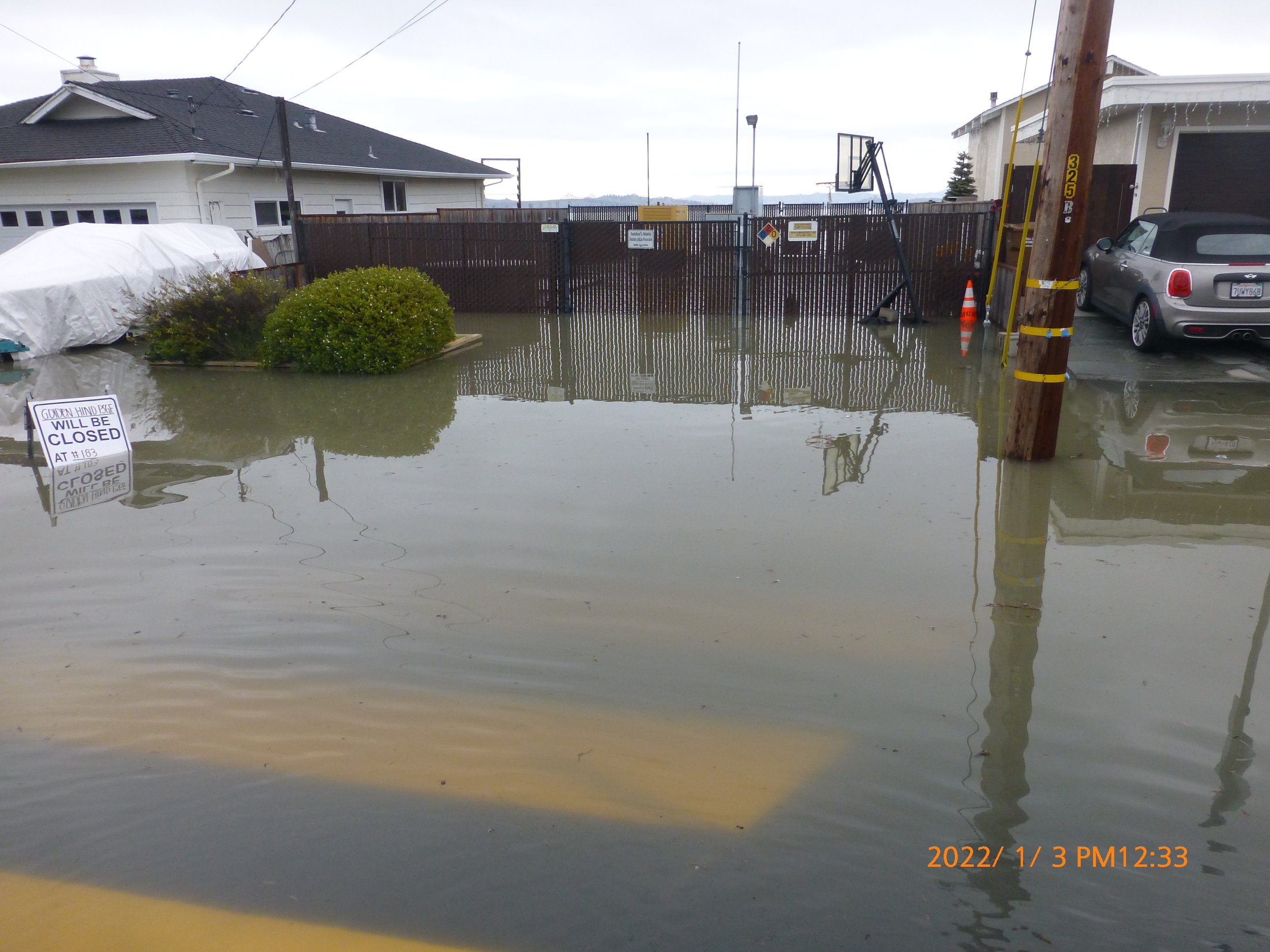
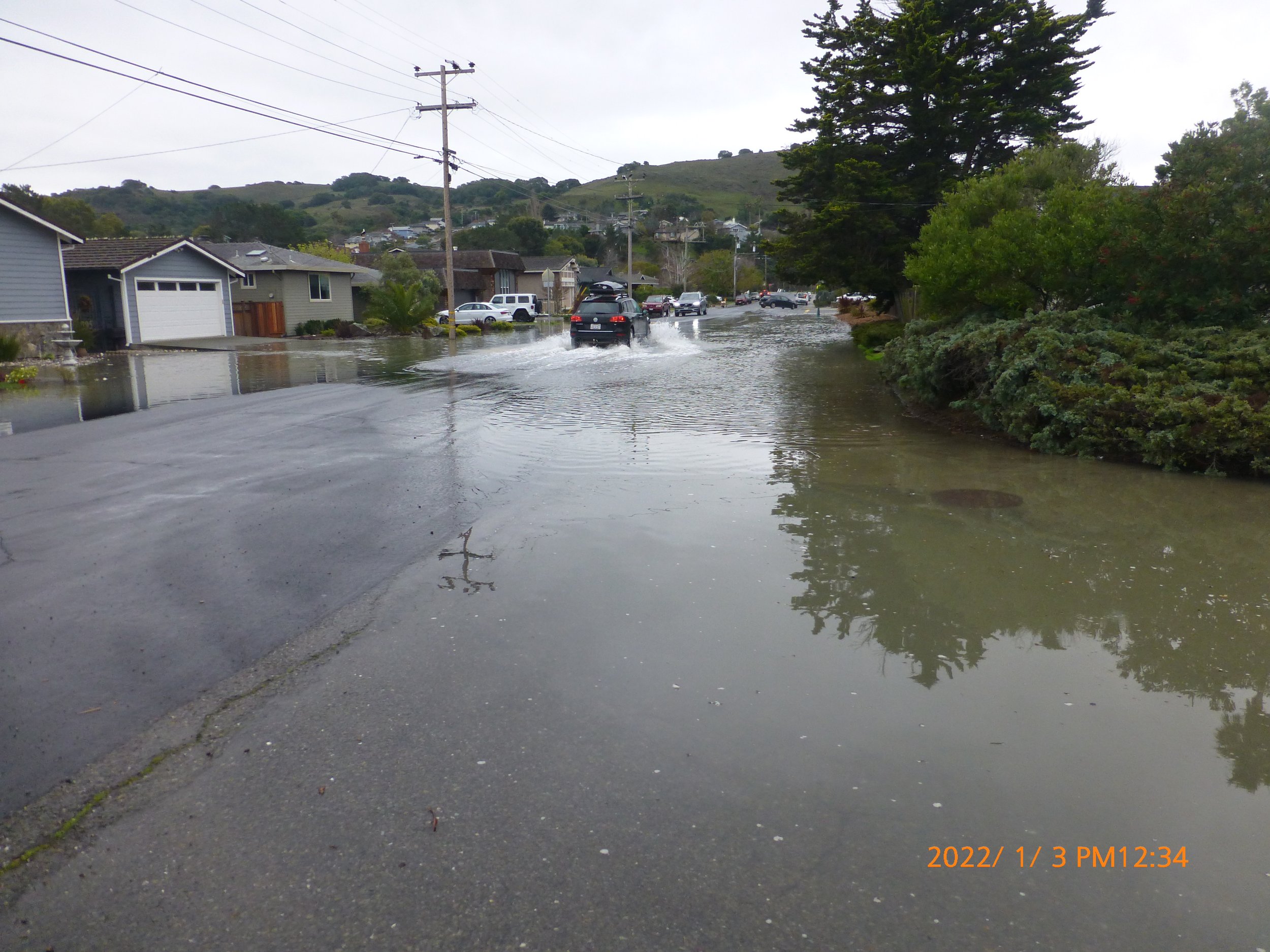
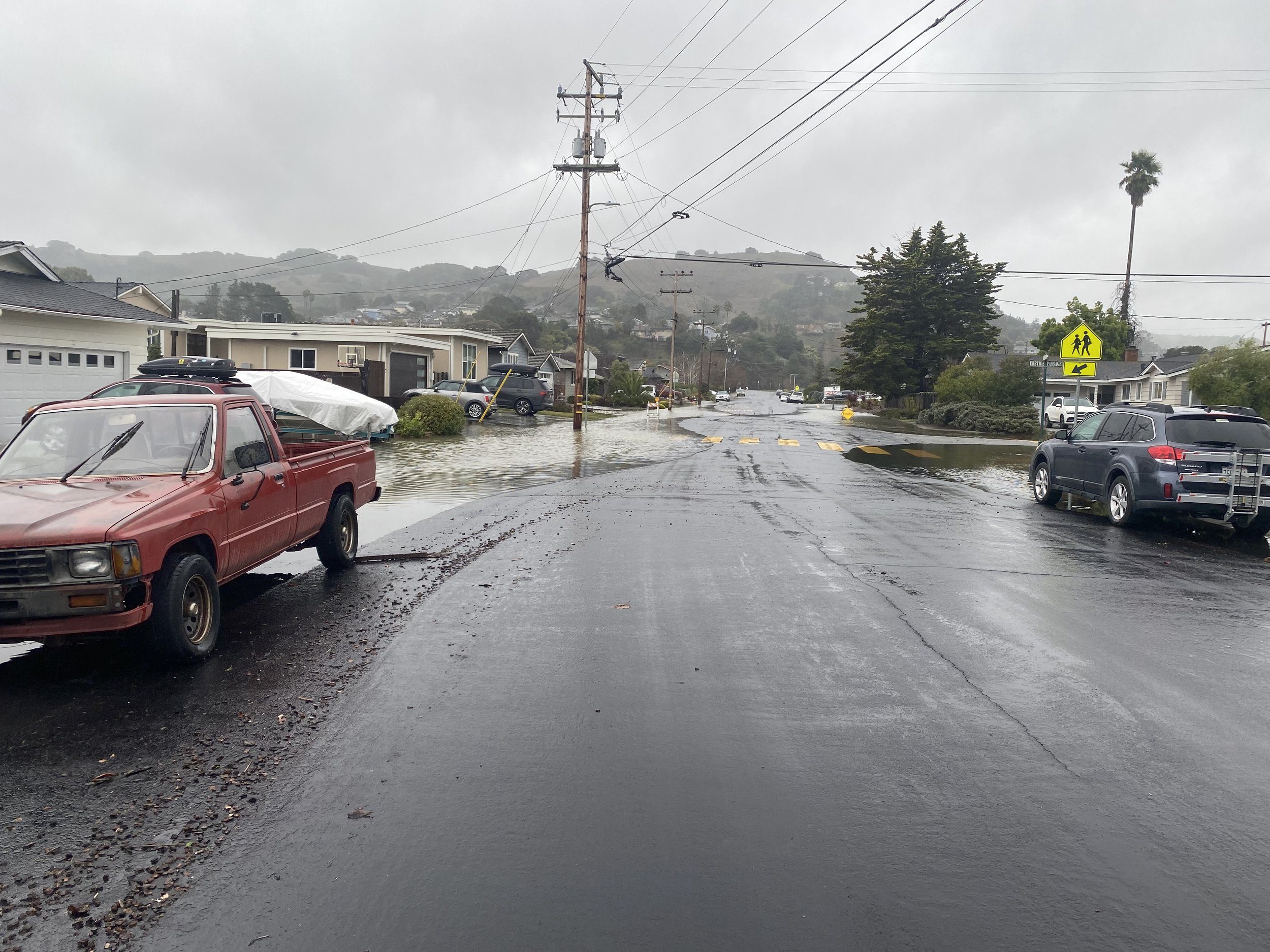
    Stormwater Runoff: Many of Corte Madera’s storm drain systems rely on gravity pipes that discharge into the bay. During high tides, the pipe outfalls are often underwater and the storm water is unable to flow into the bay as it would if the tidal waters were below the pipe elevations. Events of this nature can flood streets and temporarily overwhelm the storm drainage infrastructure until the high tide subsides, and the “gravity” storm system is able to properly release the water that was temporarily trapped. In some places, a pump station to move stormwater from the streets has been constructed, but during extreme high tide events, pump stations can be overwhelmed by the combination of storm and tidal waters. Climate change is increasing the frequency and intensity of storm events, leading to more frequent and severe flooding.

    King Tides: King tides are abnormally high predictable astronomical tides that occur approximately twice per year within San Francisco Bay. King Tides are the highest tides that occur each year and can exceed 7 feet above Mean Lower Low Water (MLLW). Learn more about king tides from NOAA and the California King Tides Project.

    Extreme High Tides: When Pacific Ocean storms coincide with high tides, storm surge due to meteorological effects can further elevate San Francisco Bay water levels to produce extreme high tides.

    El Niño: During El Niño winters, atmospheric and oceanographic conditions in the Pacific Ocean produce severe winter storms that impact the San Francisco Bay region. Pacific Ocean storms follow a more southerly route and bring intense rainfall and storm conditions to the Bay area. Tides are elevated by approximately 0.5 to 1.0 feet above normal along the coast and wind can elevate water levels even further locally. Learn more about El Niño and the emerging 2023/2024 El Niño event from the California Coastal Commission.

    Wind Wave Events: Strong winds due to Pacific Ocean storms or strong thermal gradients produce strong winds that blow across the Bay. When the wind blows over long reaches of open water large waves can be generated that impact the shoreline and cause damage.

  • Existing flood protection includes Town-maintained storm drain infrastructure, the Marina Village levee, and tidal marsh and mudflats. These features reduce, but do not eliminate, current flood impacts, and are likely to become less effective in the future without action.

    Storm Drain Infrastructure: The Public Works Department is responsible for the design, construction, operation, and maintenance of all flood control facilities within the Town of Corte Madera. These facilities include: drainage pipes, catch basins, ditches, channels, ponds, and pump stations. See the Town’s Flood Protection page for more information.

    Marina Village Levee: An earthen levee separates Marina Village from the marsh to the north. Raised earth also protects some homes along San Clemente Creek. These raised earth structures are subject to continuous settlement due to the underlying bay mud, and thus the level of protection they provide is decreasing over time. In the near future, they may be vulnerable to overtopping by ocean and/or storm surge, or may fail sooner due to erosion from more frequent and intense wave action.

    Marsh and Mudflats: Corte Madera’s remaining tidal marsh and mudflats provide ecosystem services and have intrinsic value. The marsh and mudflats act as a first line of defense between the Bay and shoreline infrastructure, reducing wave heights and protecting inland areas from bay-side flooding. Tidal marshes are vulnerable to the impacts of climate change, including erosion from increased wave action and inundation as sea levels rise.

  • The shoreline neighborhoods of Marina Village and Mariner Cove contain over 500 homes built on filled baylands in the 1950s. These neighborhoods have settled up to four feet since construction in some areas and are continuing to subside at a rate of up to 1.4 inches per decade. Already, during high tides and storm events, backyards, garages, and driveways flood. These neighborhoods currently have limited protection from flooding and face an increased flood risk as subsidence and sea level rise continue.

    A portion of the area to the south of these neighborhoods is also in the 100-year floodplain, which is defined by FEMA as “the area that will be inundated by the flood event having a 1-percent chance of being equaled or exceeded in any given year.” This area, which is also at risk of flooding, includes the shopping center on Paradise Drive and portions of the Marin Estates neighborhood.

  • The Shoreline Adaptation Engagement effort is a community engagement project aimed at developing a community vision to address current and future flood risk in Corte Madera’s bayside neighborhoods. It builds off of the 2021 Climate Adaptation Assessment, which identified reengaging with shoreline neighborhoods as a key next step to building community resilience. Launched in Fall 2023, the project will involve engaging with shoreline neighborhoods and stakeholders over several months to share information, listen to residents’ needs and concerns, and co-create next steps to build a more resilient community. See the Engagement Timeline for more details on the timeline for this project.

  • The Town is committed to an inclusive engagement process and will be holding a series of outreach events to ensure opportunities for input from residents. Visit our Get Involved page for upcoming events and opportunities to get involved and subscribe to our mailing list to stay informed. You can also contact the project team directly to share your thoughts and feedback through the Contact page. We want to hear from you!

    If you have any questions about this project, please contact Climate Action and Adaptation Coordinator Phoebe Goulden at pgoulden@tcmmail.org.

Resources

Explore NOAA’s High Tide Flooding Resources to learn more about how tides and storm events affect coastal flooding.

Watch a brief demonstration of how coastal defenses can mitigate flood risk.

Find the elevation map of Corte Madera’s Shoreline Neighborhoods here.

Read a summary of the conversations, comments, and feedback from the 1.10.24 King Tide Pop Up here.


Read the Shoreline chapter of the Climate Adaptation Assessment here.

Read the Town’s Storm Drainage and Flood Control Study, Phase 1 here.

Find the Appendices here.

Read the Town’s Storm Drainage and Flood Control Study, Phase 2 here.

Find the Appendices here.

Read the Marin Shoreline Sea Level Rise Vulnerability Assessment here.